 © Slepitssskaya/Shutterstock.com
Overview
Technology permeates every aspect of life today. It is crucial to harness its potential for the benefit of nature too. Technological innovations are proving to be game-changers for wildlife conservation by translating complex environmental data into actionable insights for practitioners, planners and decision makers. For example, advanced geospatial technologies, data science and digital platforms are supporting evidence-based decision making for biodiversity conservation, climate resilience and sustainable land-use planning. By integrating GIS, remote sensing, modelling and analytics, practitioners can undertake high-resolution ecosystem monitoring, assess human pressures and evaluate conservation outcomes across spatial and temporal scales.
Read More
OUR WORK – TECH FOR CONSERVATION

KEY PILLARS OF OUR WORK:
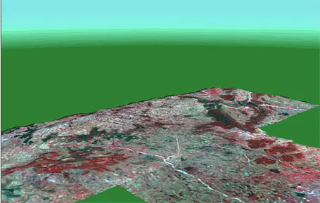
WWF-India focusses on applying GIS and remote sensing for mapping land-use and land-cover (LULC), detection of land change, mapping of habitat and biodiversity, identification of high-conservation-value areas and assessments of urban biodiversity. Advanced satellite data are used to monitor ecosystems, detect habitat degradation and assess the impacts of climate-driven changes.
WWF-India leverages statistical modelling, machine learning and deep learning techniques to assess species distributions, habitat suitability, connectivity and climate risk. Scenario-based planning tools enable evaluation of alternative development and conservation pathways, supporting proactive and adaptive management in dynamic landscapes.
WWF-India examines temporal patterns of forest fires in various states and landscapes, allowing analysts to identify emerging deforestation or fire hotspots and understand seasonal and long-term trends rather than relying on single-year snapshots. Automated geospatial workflows are employed to process high-frequency satellite data and detect floating plastic debris and accumulation zones in coastal and riverine environments of Goa and Odisha.
WWF-India integrates satellite imagery, climate variables, infrastructure datasets and field-based biodiversity observations to assess cumulative pressures on ecosystems. For instance, combining road network expansion data with wildlife movement corridors has helped in evaluating infrastructure impacts on habitat connectivity and identify priority areas in various WWF-India landscapes for mitigation measures. Through big-data analytics, WWF-India has also supported carbon sequestration assessments to identify high-carbon ecosystems, quantify carbon losses due to deforestation or degradation, and evaluate the climate mitigation benefits of conservation and restoration interventions.
WWF-India has delivered geospatial intelligence through a range of digital platforms, including theme-wise dashboards such as Align Infrastructure and PARIVESH for assessing development projects and regulatory compliance; EIACP platforms for environmental information and air-quality awareness; applications for livestock vaccination tracking and census surveys (e.g., Manas); RSPO monitoring tools for sustainable commodity certification; and many others.
WWF-India uses telemetry for animal movement studies and has been supporting radio-collaring and tracking of various animals, including tigers, elephants, rhinos, leopards, Nilgiri tahr, wolves and raptors, across Uttarakhand, Uttar Pradesh, Rajasthan, Bihar, Assam, West Bengal, Chhattisgarh, Madhya Pradesh and Tamil Nadu. Since 2016, approximately 100 radio tags have been deployed to generate high-resolution data on animal movement, habitat use and human–wildlife interactions to strengthen species conservation and landscape-level planning.
 © shutterstock.com
Support Conservation
Your contribution helps us in protecting wildlife, restoring habitats and building a better future for people and nature.
Donate